Directions to Železnik (Cukarica) with public transportation
The following transit lines have routes that pass near Železnik
How to get to Železnik by bus?
Click on the bus route to see step by step directions with maps, line arrival times and updated time schedules.
Bus stops near Železnik in Cukarica
- Trafostanica, 9 min walk,
- Gradine, 12 min walk,
- Milana Praizovića, 16 min walk,
- Svete Milutinovića, 19 min walk,
- Pijaca, 20 min walk,
- Ivo Lola Ribar, 21 min walk,
Bus lines to Železnik in Cukarica
- 55, Stari Železnik - Zvezdara,
- 521, Železnik /Taraiš/ - Vidikovac,
- 521A, Železnik /Taraiš/ - Bora Kečić - Vidikovac,
- 522, Novi Železnik - Milorada Ćirića - Novi Železnik,
- 511N, Trg republike - Novi Železnik - Sremčica,
- 512, Banovo brdo - Sremčica /Naselje Gorica/,
- 54, MZ Makiš - Miljakovac 1,
- 58, Železnička stanica Pančevački most - Novi Železnik,
- 88, Novi Železnik - Zemun /Kej oslobođenja/,
- 511NA, Sremčica - Trg republike,
- 511NB, Novi Železnik - Trg republike,
- 511, Sremčica - Beograd na vodi,
What are the closest stations to Železnik?
The closest stations to Železnik are:
- Trafostanica is 631 meters away, 9 min walk.
- Gradine is 918 meters away, 12 min walk.
- Milana Praizovića is 1168 meters away, 16 min walk.
- Svete Milutinovića is 1396 meters away, 19 min walk.
- Pijaca is 1538 meters away, 20 min walk.
- Ivo Lola Ribar is 1563 meters away, 21 min walk.
Which bus lines stop near Železnik?
These bus lines stop near Železnik: 860S, L16.
What’s the nearest bus stop to Železnik in Cukarica?
The nearest bus stop to Železnik in Cukarica is Trafostanica. It’s a 9 min walk away.
See Železnik, Cukarica, on the map
Public Transit to Železnik in Cukarica
Wondering how to get to Železnik in Cukarica, Serbia? Moovit helps you find the best way to get to Železnik with step-by-step directions from the nearest public transit station.
Moovit provides free maps and live directions to help you navigate through your city. View schedules, routes, timetables, and find out how long does it take to get to Železnik in real time.
Looking for the nearest stop or station to Železnik? Check out this list of stops closest to your destination: Trafostanica; Gradine; Milana Praizovića; Svete Milutinovića; Pijaca; Ivo Lola Ribar.
Bus: 860S, L16, 55, 521, 521A, 522, 511N, 512, 54, 58, 88, 511NA, 511NB, 511.
Want to see if there’s another route that gets you there at an earlier time? Moovit helps you find alternative routes or times. Get directions from and directions to Železnik easily from the Moovit App or Website.
We make riding to Železnik easy, which is why over 1.5 million users, including users in Cukarica, trust Moovit as the best app for public transit. You don’t need to download an individual bus app or train app, Moovit is your all-in-one transit app that helps you find the best bus time or train time available.
For information on prices of bus, costs and ride fares to Železnik, please check the Moovit app.
Use the app to navigate to popular places including to the airport, hospital, stadium, grocery store, mall, coffee shop, school, college, and university.
Železnik Address: Železnik, Belgrade, Serbia street in Cukarica
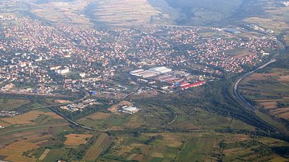
Železnik (Serbian Cyrillic: Железник; pronounced [ʒě̞le̞zniːk]), is an urban neighborhood of Belgrade, the capital of Serbia. It is located in Belgrade's municipality of Čukarica.Wiki
Attractions near Železnik
Ulica Milovana Niciforovica 80,Ulica Ucitelja Vlade Ilica,Ulica Gradine 5Г,Darko Art Tattoo,Ulica Gradine,Улица Градине,Ulica Stevana Sremca,Ulica Djure Jaksica,Ulica Milovana Niciforovica,Vrtić Kefalo,TIM MARKET,Ćuku ćuku,Tarais,Ulica Djure Jaksica 3,Ulica Stevana Sremca / Zeleznik,Ulica Svete Milutinovica / Zeleznik,Ulica Svete Milutinovica 27,Antiaging Studio Za Negu Lepote Dan - Beograd,Ulica Nebojse Markovica / Ulica Djure Jaksica,Svete MilutinovićaHow to get to popular attractions in Cukarica with public transit
Erste Banka, Novi Beograd,Blok 8a, Novi Beograd,Tošin bunar, Novi Beograd,Terasa Knez, Novi Beograd,Aviator Coffee Explorer, Vracar,Škola za dizajn, Savski Venac,Borča, Palilula,Zemun | Novi Grad, Zemun,City Caffe, Novi Beograd,Stanica, Vracar,Medaković, Vozdovac,Nbg Gym, Novi Beograd,Užice, Savski Venac,Poncho, Novi Beograd,Batajnica, Zemun,Železnik, Cukarica,Stajalište gradskog prevoza Sajam, Savski Venac,Kotež, Palilula,Troy, Zvezdara,Domino, Novi BeogradGet around Belgrade by public transit!
Traveling around Belgrade has never been so easy. See step by step directions as you travel to any attraction, street or major public transit station. View bus and train schedules, arrival times, service alerts and detailed routes on a map, so you know exactly how to get to anywhere in Belgrade.
When traveling to any destination around Belgrade use Moovit's Live Directions with Get Off Notifications to know exactly where and how far to walk, how long to wait for your line, and how many stops are left. Moovit will alert you when it's time to get off — no need to constantly re-check whether yours is the next stop.
Wondering how to use public transit in Belgrade or how to pay for public transit in Belgrade? Moovit public transit app can help you navigate your way with public transit easily, and at minimum cost. It includes public transit fees, ticket prices, and costs. Looking for a map of Belgrade public transit lines? Moovit public transit app shows all public transit maps in Belgrade with all Bus, Train, Light Rail and Trolleybus routes and stops on an interactive map.
Belgrade has 4 transit type(s), including: Bus, Train, Light Rail and Trolleybus, operated by several transit agencies, including GSP Beograd - Dnevne Linije, Srbijavoz - BG Voz, GSP Beograd - Minibus Linije, GSP Beograd - Noćne Linije, Belgrade Airport Shuttle, Lasta, Strela - Obrenovac, Pantransport Pančevo - Gradski Prevoz, Međugradske Linije